On The day of our walk, we caught the bus to Swansea, from just outside The Twelve Knights in Margam, where we would be later spending night.
From the bus station we walked the short distance to pick up the Wales Coast Path in Swansea Bay.
Fast easy walking on the flat, past new apartment blocks on the edge of the bay.
Walking very slightly inland in we approached the weir.
We walked across the weir towards Prince of Wales Dock, where we found the coast path signage a little patchy and had retrace our steps at least once to get on the right track.
Looking across the weir to the new developments.
The beautiful Norwegian Church - grade 2 listed, no longer used for services.
In contrast to all the new developments in Prince of Wales Dock, we soon found ourselves walking past the Crymlyn Bog National Nature Reserve.
In order to cross The River Neath, we had to cross some rather high bridges, which made us feel somewhat weak at the knees. The photograph on the left looks back to the A48 bridge from near to Baglan Bay.
The accumulator tower that used to house the steam powered hydraulic system that operated a single floating dock, as part of the now defunct Britain Ferry Dock. Designed by Isambard Kingdom Brunel, it was completed two years after his death in 1859.
Looking down towards Baglan Bay and the mouth of the River Neath.
From the same spot looking upstream towards the M4 and A48 bridges spanning the river.
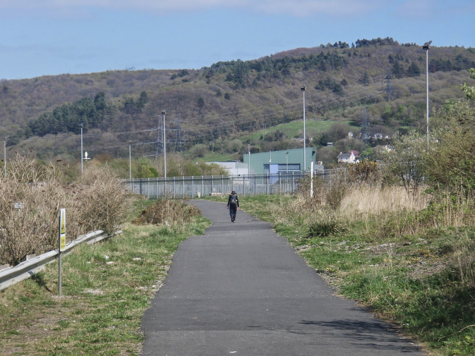
The man striding into the distance is Pete Hill, who is walking around the coastline of Britain in one go. Walking 20 miles a day, with just one day off a week! We stopped and compared notes with Pete, who is walking to raise money for a couple of charities. His website and blog are well worth a read - www.gbcoastwalk.com.
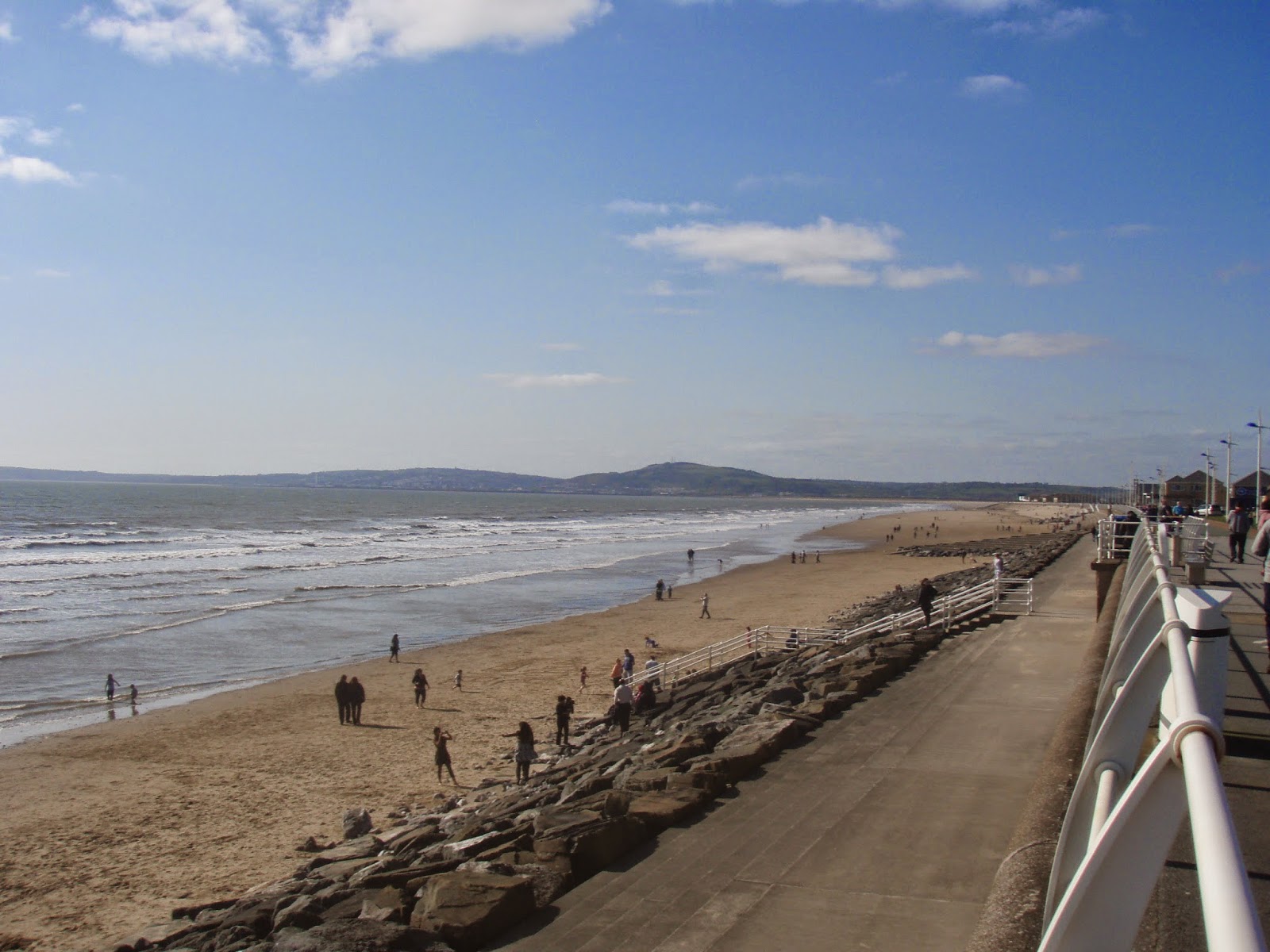
The Wales Coast Path, then took us past the beautiful dunes (above) and sandy beach (below) of Aberavon Sands.
We then arrived at the leisure part of Aberavon Sands, to the North of Port Talbot. It was a beautiful hot day, so Julie and I indulged in a very refreshing ice-cream, whilst sitting on the edge of the sands admiring the view.
As we progressed along the front, we could see the industrialisation of Margam and the steam/smoke billowing from the Tata Steel works.
Looking back, from where we had walked towards the mumbles.
The last photograph of our walk as we walked along the River Avan, just outside Port Talbot. From here we walked back to Margam and to re-join the start of our walk at The Twelve Knights, from here we drove back to Gloucester.
We caught the bus from Margam to Ogmore-by-Sea. Thus linking up with day one of our walk on 9th March 2014.
The photograph on the left shows the start of our walk north up the coastline of Wales.
Looking North to Porthcawl.
The mouth of the confluence of the Rivers Ogmore and Ewenny, which cannot be traversed on the coast, necessitating a long walk inland to the first crossing place.
The walk inland along the banks of the river.
We just had to include this photograph of this pub with the most unusual name we have ever seen 'The Pelican in her Piety'!
Our walk then took us by the remains of the Norman Ogmore Castle, which was probably built in 1106.
The biggest challenge of this walk, walking over the stepping stones on the River Ewenny and not falling in, it was quite deep in the middle and some of the stones were slippery (apologies for the sideways photograph).
The beautiful parish church of St Teilo at Methyr Mawr.
The remarkable Merthyr Mawr Warren. Like walking through fields of sand. A very strange landscape and did not make for easy walking by any means.
More views of the warren, which is known locally as the 'Big Dipper'. Scenes for the film Lawrence of Arabia were shot here!
We became a little lost in the warren, but followed our noses to the sea, emerging somewhere near to Newton Point.
Looking North towards Porthcawl and the direction of our walk.
Looking southwards back to Ogmore-by-sea in the far distance.
Onwards past Porthcawl Marina.
The view North from the far end of Porthcawl.
The photograph below shows the view of Rest Bay just outside Porthcawl.
Just north of Porthcawl we found our path had once again been washed away by the winter storms. The photograph on the left shows the remains of the boardwalk. Like a few other walkers we decided to press forwards and not take the lengthy diversion suggested.
In the distance The Great House at Sker, which began it's origins as a monastic grange 900 years ago.
This and the next four photographs show views from The Kenfig Pool and Dunes National Nature Reserve, through which the Wales Coast path passes. The white smoke coming from a chimney in the distance, originates from the infamous (for walkers), Tata steel works in Margam.


The Tata Steel works close up. The coast walks takes a wide diversion around this. Julie and I decided to take a leaf out of books of many walkers who have travelled before us and actually walk through the works. there is currently a dispute between The Crown and the owner of the works about who owns the land at the sea front. If you would like to retrace our steps follow these instructions. Where the coast path diverts, do not follow the diversion, but instead walk straight ahead, continuing past signs saying 'Private'. Eventually you will reach a metalled road, close to the coast. Follow this straight ahead until you come to a weighbridge with some disused green huts on it's left. The first turning on the right after this point is a public footpath, walk up this footpath and you will eventually rejoin the coast path. If you follow these instructions you will almost certainly be challenged by one of the steelworks security guards. If you ask them for the footpath, they will give you instructions if you are lost. The one we spoke to was very helpful and polite!

Andrea (and Julie below) at the end of our walk, at our accommodation for the evening The Twelve Knights at Margam.
We drove from Gloucester to Llantwit Major and parked at the bus/train station in the centre. We caught a bus to Ogmore-by-Sea, the start of our walk.
On the left, Julie ready for the off at the station.
As we reached Ogmore, dramatic views of the coast appeared, with some of the largest ocean swells, certainly I have ever seen.
Fishermen trying to keep upright as the large waves reach the beach at Ogmore.
Looking Southwards, the direction of our walk towards Trwyn y Witch (The Witch's Nose), the headland in the distance.
Our walk took us along the coast until we reached Dunraven Bay, with Trwyn Witch in the near distance.
Beyond Dunraven Bay, are the pretty walled Dunraven Gardens belonging to the castle.
The Wales coast path opened in 2012, already cliff erosion means that sections of the walk are not as they were on opening. On the left, there is a gate, still with the coast path emblem on it, hanging precariously over the cliff edge!
Views of the coast somewhere in the vicinity of Traeth Mawr.
Views of the coast somewhere in the vicinity of Traeth Mawr.
Views of the coast somewhere in the vicinity of Traeth Mawr.
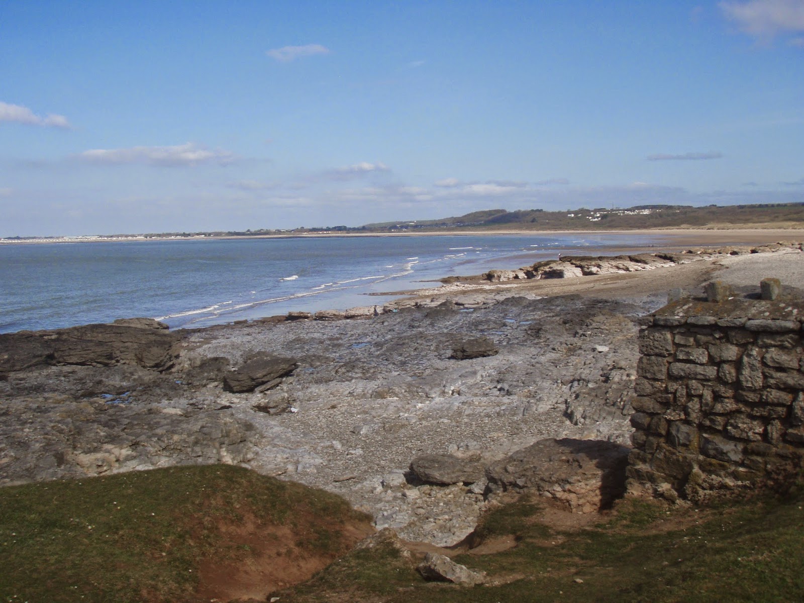
The long stretch of coastline, with no name, stretching towards Nash Point.
Trinity House instructed Joseph Nelson to construct two towers at Nash Point, following the sinking of the passenger ship 'Frolic', with the loss of 78 lives. The lighthouses were completed just 11 months after they were started, which was an amazing engineering achievement.
The coast path cuts straight through the site of the lighthouses, for close up views of both towers, the fog horns (see below) and the large aerial by the tall tower, which is one of the Differential Global Positioning Systems (DGPS) land based transmitters, which helps vessels navigate the coast.
Un-named coastline between Nash Point and St Donat's Point.
We progressed over the King George V Playing Fields. After the kings death in 1936, 471 playing fields were created in his memory.
Looking towards Tresilian Bay.
Julie, walking down the steps leading to the beach at Llantwit Major.
The beachfront at Llantwit Major, the rocks and boulders strewn around evidence of the winter storms earlier in the year. From the beach front we walked inland, return to the bus/train station. We drove the short distance to our accommodation for the night, The Newcourt Bed and Breakfast on the Cowbridge Road. We would very much recommend this establishment. A b and b with a difference. See reviews on Tripadvisor for details.